Major road closures hit inner-city suburbs for Run Army 2026
Fortitude Valley, the Brisbane CBD, and surrounding inner-city suburbs experienced significant traffic disruptions on Sunday 29 March 2026. The changes were implemented to facilitate the Run Army 2026 event, a large-scale community running activity.
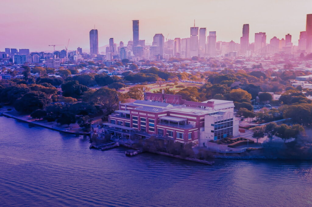
According to the City of Brisbane, full and partial road closures were in place from 3am until 9.30am across multiple key corridors. The event restricted access to major arteries including the Story Bridge, Ann Street, and the Cultural Centre Tunnel.
Detailed closure timeline and locations
The City of Brisbane confirmed that traffic and parking conditions altered across South Brisbane, Woolloongabba, Kangaroo Point, Fortitude Valley, and the Brisbane City centre. The most severe restrictions began early, with some roads closing as early as 3am.
In South Brisbane, the Cultural Centre Tunnel between Stanley Place and Stanley Street faced a full closure from the 3am start time. Russell Street, Grey Street, and Glenelg Street also saw full closures during this initial window. The Council noted that slip lane access from Fish Lane to Peel Street remained available on Grey Street between the William Jolly Bridge and Melbourne Street.
Fortitude Valley residents and commuters faced full closures on the Bradfield Highway (Story Bridge) between Main Street and Kemp Place. This restriction lasted from 5am to 9.30am. Other fully closed roads in the Valley included Bowen Terrace, Martin Street, McLachlan Street, and the Ivory Street Tunnel.
The Brisbane City centre saw an extensive network of full closures starting at 5am. Adelaide Street, Queen Street, and Creek Street were completely blocked to general traffic. The City of Brisbane data shows that bus access was maintained on Eagle Street between Elizabeth Street and Charlotte Street, and on Edward Street between Turbot Street and Ann Street.
History of event traffic management in the CBD
Large-scale running events have become a recurring feature of the Brisbane inner-city calendar. These events often necessitate complex traffic management plans to ensure participant safety while minimising disruption. The City of Brisbane has a history of implementing early morning closures to clear the CBD before the morning commuter peak.
The use of the Story Bridge as a key route for such events is not new. The bridge serves as a critical link between the CBD and the northern suburbs. Its closure for Run Army 2026 followed a pattern of using this infrastructure for major sporting and community gatherings. The closure of the Bradfield Highway between Main Street and Kemp Place effectively severed the primary road link for the duration of the event.
Historical data from the City of Brisbane suggests that similar events often utilise the same grid of streets in the CBD. Roads such as George Street, Ann Street, and Edward Street frequently appear in closure lists for major city events. The 2026 iteration of Run Army adhered to this established geographical footprint.
The timing of the closures, specifically the 3am start in South Brisbane, reflects a strategy to allow event setup and participant assembly before the general public begins their daily commute. This early window is standard for events requiring large-scale road occupation in high-density areas.
Impact on local residents and businesses
Residents living in Fortitude Valley and the CBD faced significant access challenges during the closure period. Those relying on the Story Bridge for their morning commute had to find alternative routes or delay their travel. The closure of the Bradfield Highway and McLachlan Street meant that the main north-south and east-west arteries were unavailable.
Businesses in the CBD, particularly those on Queen Street and Adelaide Street, experienced a lack of vehicular traffic during the 5am to 9.30am window. While some bus access was maintained, the full closure of these streets likely impacted early morning deliveries and staff arrivals. The City of Brisbane notes that full closures on major streets like George Street and North Quay would have diverted local traffic to surrounding suburbs.
South Brisbane residents faced disruptions to the Cultural Centre Tunnel, a key access point for the suburb. The full closure between Stanley Place and Stanley Street from 3am to 9.30am meant that early risers and workers at nearby institutions had to navigate around the blocked tunnel. The half-closure on Grey Street further complicated navigation through the area.
Kangaroo Point residents saw the Main Street corridor, a vital link to the Story Bridge, completely closed between Sinclair Street and the Bradfield Highway. This closure, combined with restrictions on River Terrace and Ellis Street, isolated parts of the suburb from the city centre during the early morning hours. The impact extended to the Shafston Avenue slip lane, which was also closed.
Specific restrictions in surrounding suburbs
Woolloongabba experienced half road closures on Main Street between Vulture Street and Sinclair Street. These restrictions were in place from 5am to 9.30am. The partial nature of these closures allowed some traffic flow but likely caused congestion as vehicles navigated the narrowed lanes.
In Kangaroo Point, the closure of Lower River Terrace and Leopard Street created a perimeter around the riverfront. The full closure of these roads from 5am to 9.30am prevented direct access to the riverfront parks and residential areas during the event setup and run phase.
Fortitude Valley also saw half closures on Marshall Street and Gipps Street. These partial restrictions added complexity to the traffic network, requiring drivers to merge into single lanes on key arterial roads. The Ivory Street Tunnel closure was particularly significant, as it is a major connector within the Valley.
The Brisbane City centre saw a web of closures that effectively turned the central business district into a pedestrian and event zone. Streets like Tank Street, Makerston Street, and Herschel Street were fully closed, limiting access to the southern and eastern edges of the CBD. The William Jolly Bridge was also closed between North Quay and Grey Street, cutting off a key river crossing point.
What to watch for future events
The City of Brisbane has confirmed that traffic conditions returned to normal after 9.30am on Sunday 29 March 2026. Commuters and residents should monitor the Council website for future announcements regarding similar events. The pattern of early morning closures is likely to continue for large-scale running events in the inner city.
Residents in the affected suburbs are advised to check the City of Brisbane traffic updates before planning early morning travel during major event dates. The specific list of closed roads and times is published in advance to allow for route planning. Future events may utilise similar road networks to ensure safety and logistical efficiency.
The successful execution of Run Army 2026 relied on strict adherence to the published closure times. The City of Brisbane will review traffic flow data to inform future event management plans. This data will help balance the needs of event participants with the daily requirements of the local community.
Sources
- https://www.brisbane.qld.gov.au/about-council/news-and-community-updates/community-service-announcements/march-2026/changed-traffic-and-parking-conditions-in-south-brisbane–woollo
- https://roads.sunshinecoast.qld.gov.au/Home/MapSearch
- https://www.skagitcounty.net/Reporting/RoadClose/